Camera of iPad Produces Violation of Class C Airspace
 |
| Tallahassee, FL Class C airspace. Our southbound route is depicted by the green line. |
But the trip also showed that the information may become corrupted when other iPad apps are invoked in flight, without a hint that things have gone wrong. Here are the details.
We take off from the Marianna, FL airport early in the morning. Shortly thereafter we transit the outer ring of the Class C airspace of the Tallahassee airport. That ring demands flight to be below 1400 ft. Selecting an altitude of 1200 ft MSL, we satisfy that condition; see the green route in the above screenshot.
As we near the Gulf Coast of Florida, numerous water channels meander out into the Gulf. Unfortunately, it is quite hazy, and our camera would not produce an interesting photo. But we are wondering if the camera of the iPad, which has the HDR (High Dynamic Range) option, might derive an interesting photo from the hazy, almost gloomy landscape. That option shoots a quick sequence of photos at different light levels, then combines them into one photo with rich colors.
We take several photos and like how HDR brings out the sunshine spots dappling the marshy land. We just have found another good use of the iPad on board of the aircraft.
 |
| Gulf Coast southeast of Tallahassee |
A moment of horror: The airplane icon, with additional blinking blue dot to emphasize the location, is back in the outer ring of the Tallahassee Class C space! We are flying at 2000 ft MSL, so we are inside the Class C airspace with its 1400 ft floor!
But hold a second, we passed that airspace half an hour ago! Evidently, the Garmin Pilot is completely confused about our location.
Of boy! We need the Garmin Pilot to work when we get to Tampa, since we intend to thread a tight route under the Tampa Class B space: We must avoid high towers to the East and stay away from the tightly restricted portion of the airspace to the West.
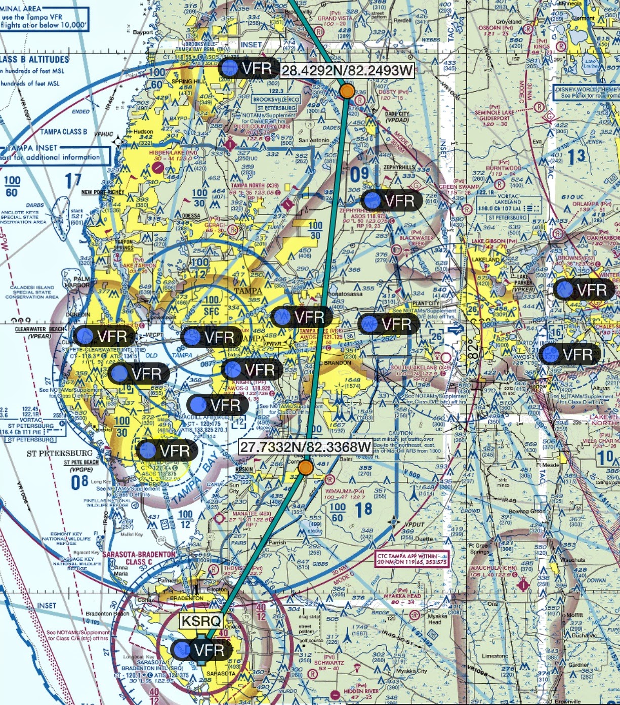 |
| Tampa Class B and Sarasota Class C airspace require precision navigation. The green route ends at our destination, the Sarasota/Bradenton International Airport (KSRQ). |
We shut down both the iPad and the GDL39, then turn them on again. Next we start the Garmin Pilot, then establish the Bluetooth connection with the GDL39. With great relief, the aircraft icon pops up where it is supposed to be!
The lesson to be learned: When the Garmin Pilot is essential during a phase of flight, never ever switch to the camera of the iPad to take pictures. The navigation information may get corrupted without warning.
We don’t know whether other apps of the iPad can trigger this problem. On that same trip we switched back and forth between the Garmin Pilot and the Notes app to review the procedure needed for entry into the Sarasota Class C space. There was no detrimental effect. Maybe it is just the camera, with its complex HDR processing steps, that can have such disastrous effect.
Have any questions or feedback about the use of various functions of the iPad in the cockpit? Please share your thoughts in the comments.


Turn off GPS /Geo location tagging when taking photos. The issue is 'sharing' the iPad's GPS data between apps.
ReplyDeleteThanks for the comment. Would be kind if you expanded upon your explanation, by showing how the Garmin Pilot GPS information, which is produced by the Garmin GDL 39, got corrupted, and an entirely wrong location got inserted and was no longer updated. Is this caused by the GPS location that the camera inserts into the photos?
Delete